
Map Design Using QGIS
These are a few maps I created using QGIS and data/tutorials from QGIS Map Design by Anita Graser and Gretchen N. Peterson (Locate Press)
This design recreates the old water colour look you saw on globes in school

By highlighting the borders of the countries with a shapeburst technique I attempt to visually separate more important parts of the map (the country borders) from the less important areas.
Tools Used: topological colouring, blur, shapeburst
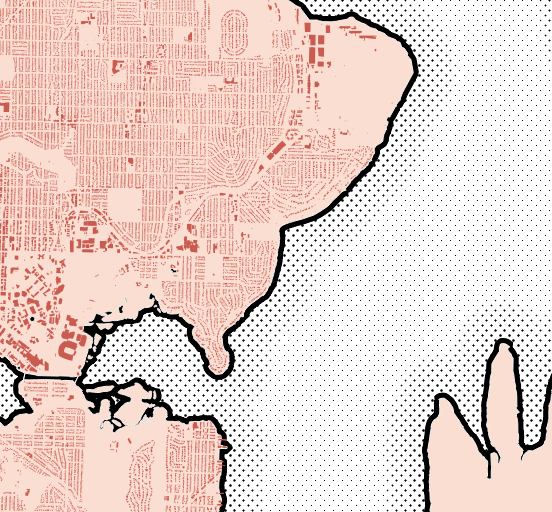
Ben Day dot-style map of the Seattle area.
Tools Used: Shapeburst, Pattern Dot Symbol, Point Pattern Fill, Dodge,
A thematic map of coffee shops in Seattle.

Created using the following steps:
Imported polygon layers from the Openstreetmap database and filtered using “natural” = ‘water’ AND amenity IS NULL in order to only show the bodies of water.
Duplicated the layer and used Inversepolygon in order to symbolize the land area.
Filtered the line feature class from OSM using “highway” NOT NULL
Added the point data from OSM and filtered by “other_tags” LIKE “%coffee%” in order to pull out all the points that contain any variation of the word coffee.
Added an SVG coffee icon after editing the parameters to allow for changing the colour to brown.
Used rule based styling to make all Starbucks locations light brown and other coffee shops dark brown
Used rule based styling to also differentiate the text colour between Starbucks and other coffee shops.
Added a slight coloured buffer on the labels to allow for separation between the text and underlying features.
Completed the layout fully within QGIS